Wednesday, August 30, 2017

Riding with BeemerGirl and OilBurner on Pikes Peak

Took the day off from work to go riding on Pikes Peak (America's Mountain) with Lori aka BeemerGirl, a motoblogger who writes "For Love of a Motorbike" and her husband Chris aka Oilburner.

They'd come down from the Brainard Lake area yesterday evening and stayed overnight visiting.

We left the house at the crack of 9AM and by 11AM we were at the fee station at the base of Pikes Peak, sunny conditions, not much wind, pretty much perfect weather conditions except for hazy conditions which affected how far out we could see.  This outing I was riding Brigitta, my '87 R80 Beemer.

BeemerGirl led the group up to the summit, seeming to display a special fondness for being near the double yellow lines separating the traffic going up and down the mountain.  ;)

I kid of course, she and Oilburner did great on the way up, around and then down the mountain.  And yes, we were NOT the slowest folks on the mountain today, plenty of drivers in big manly pickup trucks were bypassed by us as they drove slow and nervous.

 Lori and Chris at the requisite Summit Sign picture

 BeemerGirl atop Pikes Peak


 At the Bottomless Pit


 Incoming storm started masking the peak as we made our way down

After a nice lunch at Rudy's BBQ near Old Colorado City, we made our way for a quick tour of the Garden of the Gods.

 Garden of the Gods

 Balanced Rock

Soon it was time to hit the I-25 Super Slab northward to the exit to Colorado 105 Highway near Monument, CO.  We cruised on this nice motorcycling road for a while, happy to leave the chaos of the interstate behind.  It did rain on us a little bit but nothing to get excited about before we made it to Sedalia where we fueled up.

About 200 miles of riding with Lori and Chris, and I believe fun was had by all.  We chatted all during the ride through our helmet intercom units, taking turns assuming (quite involuntarily) the title of "Captain Blinkie" whenever one of us forgot to turn off a turn signal after making a turn.

I said my goodbyes at Sedalia as Lori and Chris were heading back towards Brainard Lake where they've been staying.  I entered rush hour traffic on eastbound C-470 but once I got on the E-470 tollway, it was smooth sailing all the way home, under sunny skies.

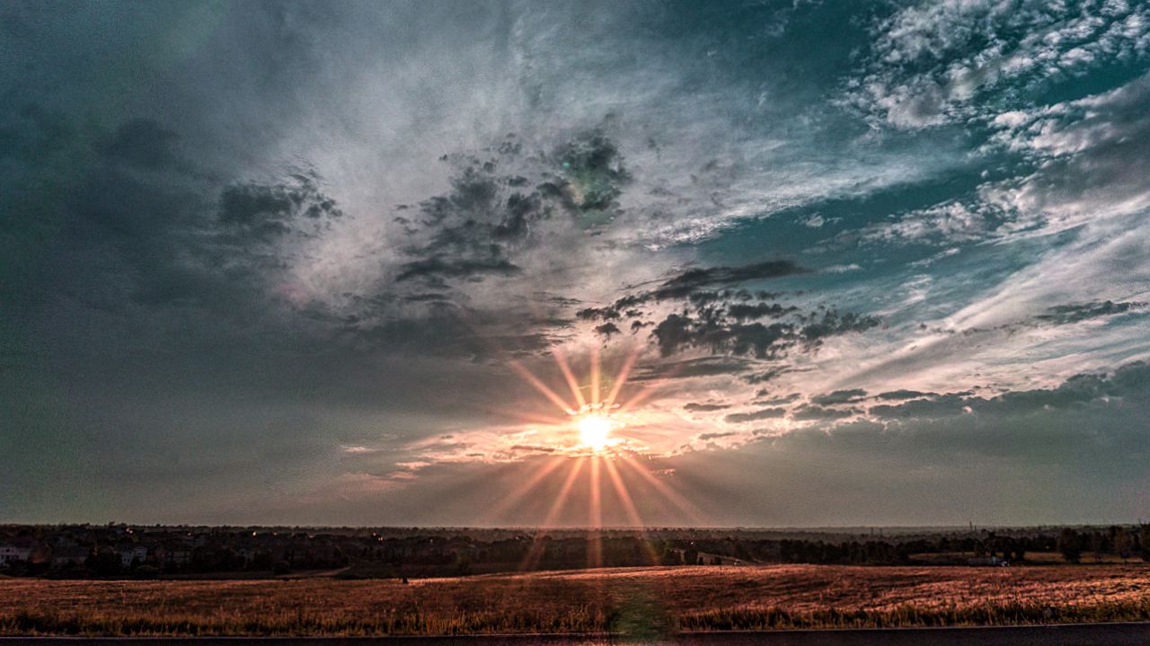
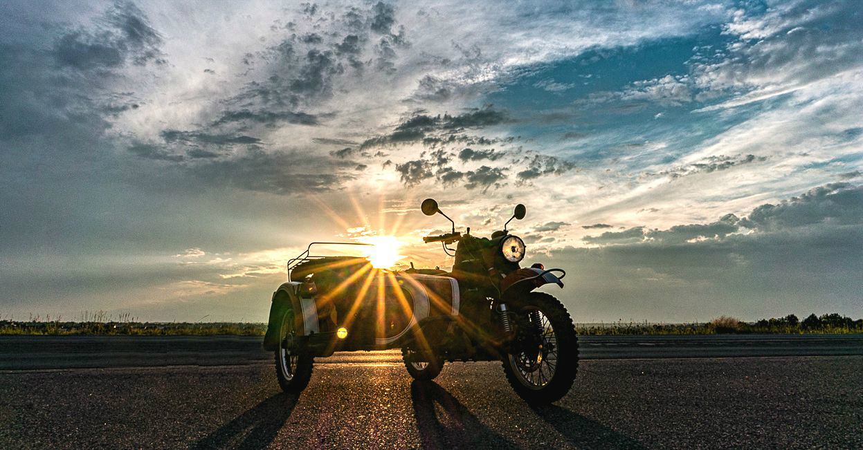
Finally a few pics of tonight's "fair" sunset.  A good day of riding with friends, showing them a little bit of Colorado, making memories.  


Sunday, August 27, 2017

After the Eclipse of 2017 - a slow week of sunsets

Got home from Nebraska the day after the big Solar Eclipse of 2017, avoiding all the reported traffic jams.

Uma, the URRV did fine throughout the trip up and back, no issues to report.

 Tuesday's Sunset to welcome us back home


 Wednesday's Sunset - A little mini-eclipse by 
Scarlett's Mirror


 Yours truly, taken by Shaun C. who stopped
by to say hello
 Thursday's sunset with Brigitta


 Friday's Sunset
 with Fiona


 Saturday's Sunset


 Sunday's sunset with Scarlett


Monday, August 21, 2017

Scarlett and the Eclipse of 2017

As I mentioned in the previous posting, I'd traveled to Oskosh, Nebraska to be able to view the solar eclipse with 100% totality.  That means the moon would have blocked the sun 100%, briefly, and the corona would be visible.

The location where I parked Umarang, my URRV, which I used to tow Scarlett up proved a good spot to observe this astronomic phenomenon.

Here's Scarlett, in Trish and John's front yard, their old horse stable in the background next to their windmill.  The picture was taken just as the eclipse was starting so plenty of light arriving from the sun.


John and I sat on the porch in the shade, keeping track of the progress of the eclipse as it started blocking more and more of the sun.

We could feel the air cooling as the sun became more and more blocked by the moon.  Neat.

At totality, which only lasted like 28 seconds for our location since we were at the southern edge of the eclipse's path, here's what it looked like.

Slightly post-processed so you could actually
make out Scarlett....
Shortly after totality had passed.
Shot in Auto mode, no retouching except for resizing/cropping.

As alluded to in articles on the Internet, it was like having sunset occurring 360 degrees around us.  I thought that was pretty neat, even though it didn't last very long.

We could see our shadows still, kind of like walking around under a bright full moon one clear night.  John's yard light came on, being fooled into activating due to the darkness that briefly occurred.

Only had time for 4 shots, this was the best one

 Several minutes before Totality

closeup view of the first eclipse shot

No reaction from the nearby horses, the dog Shasta or their barn cat that I could see.

It was dusky, nice and cool with temperatures in the mid-70s.  Someone reported temperatures dropped a total of 7 degrees Farenheit during totality.

Too soon it was over of course, and we went to lunch.  Here's a movie of Scarlett showing the light levels as totality approached, occurred and then the moon started moving off the face of the sun.  The video is shown at 10x normal speed.


Sunday, August 20, 2017

Oskosh, Garden County, Nebraska

Yep, in the Cornhusker state today, traveled here yesterday, Saturday, on Umarang, the URRV, towing Scarlett, my 2014 Ural Patrol Rig on the trailer.

I am staying with a couple, the wife Trish is a Nurse College friend of Martha.  She and John, her husband own what they call a "small" farm just west of the small town of Oskosh, Nebraska.

They very generously are letting me moochdock on their property, supplying me with power and water.

This morning, Sunday, after a late wake up, I motored out of their farm on Scarlett and went to explore Garden County.

First it was a quick jaunt into town to catch Road 179, heading north on this county road, towards the Crescent Lake Wildlife Refuge.  It's apparently going to host an Eclipse event but I was just curious as to what passes for such a place in Nebraska.

The road quickly became packed dirt with the occasional patches of deep sand to get one's attention, still I was able to maintain mostly 35 mph on this road and 25 miles later I was at the refuge.

It's basically rolling hills, grassland and very few trees along the road; several lakes dot the landscape but it basically came across to me as a place to go fishing.  I saw several trailers and campers just outside the refuge but cell coverage was nil.


After wandering around a bit, I continued through the reserve and using Rd 180 got (eventually) to Rd 155 so that I wouldn't have to backtrack along Rd 179 back to Oskosh.

All this was packed dirt, again with the occasional patches of loose sand to encourage one not to go too fast between the hills.  Very hilly country was transited using this road and the sand tended to collect (duh) at the bottom between the hills.

Soon enough, I made my way through a set of county roads which went around large farms and found the junction to Highway 26.  Took this highway back into town and I fueled up at the kwikmart before turning south on State Highway 27.

First up was exploring an Oregon Trail Historical Marker I'd spied on the way into town yesterday:


 You can see the first stone marker over to the right, the
road led to John Hollman's actual gravestone.

 Near this marker on the right side of the road, on private property, is the gravesite.
The site is open to the public, through a nearby red gate that was secured just with a chain for easy securing of the gate.


It didn't strike me until later, as I processed the above pictures and reading the information both on the plaques and on the Internet, that John Hollman might have had relations back in Wisconsin.  Further, these relations, the Hollmans were somehow related to the folks who found the town of Holmen, Wisconsin.

Holmen is where my FIL spends his summers when not snow-birding in Arizona or traveling to Norway and other parts of this world of ours.

Makes you wonder, doesn't it?

Next it was a 15 mile or so ride south along State Highway 27 till just past the border into Deuel County for a picture of a large sunflower field I'd also spied on the way in yesterday.


The heat of the afternoon, which was quite warm, had caused the flowers to be a bit droopy or perhaps the flowers themselves had become heavier than what the stalk could support?

Now heading back north along the same highway, I took a slight detour onto Rd 175 to explore what appeared to be interesting looking geological formations.  The picture below is looking north towards Wildhorse Canyon and the small specks flying above on the left are above Eagle Cliff.


They looked like vultures to me when I rode closer but I guess they could have been eagles.

Once back in Oskosh, I discovered the local version of a grocery store, the superette was closed on Sundays.  Doh.  I headed back to Trish and John's farm and cooled off a bit while writing this.

Tomorrow is the eclipse and if the "partly cloudy" forecast cooperates, I may not have to ride anywhere to pose Scarlett suitably to capture the changing light conditions during the Eclipse.

I don't plan to capture the eclipse sequence as the Moon gradually slides across the face of the sun; plenty of such shots will no doubt be available on the Internet soon after tomorrow.

I do hope to capture a shot or two of the eclipsed sun during totality....we'll see how that goes.


Saturday, August 12, 2017

Meeting BeemerGirl and Oilburner

Martha and I, riding on Scarlett, my 2014 Ural Patrol Sidecar rig...rode into the nearby mountains to the town of Nederland (Home of the Frozen Dead Guy) this morning.  The mission was to meet fellow moto-blogger Beemergirl aka Lori and her husband Oilburner aka Chris.

We met at the New Moon Bakery and Coffee Shop and chatted up a storm while enjoying some Bacon Wraps.  Well, mostly Lori and Martha chatted up a storm while Chris and I jumped in every now and then.

After breakfast, and since Chris had a couple of hours before having to report to work at Brainard Lake Recreation Area (where they're sort of work-camping); we rode out towards Rollins Pass.  Chris and Lori on their spiffy Honda CBX500X motorcycles.  Martha dubbed them Thing One and Thing Two, the motorcycles that is, since they'd not named them yet!

We got to the eastern entrance of the Moffat railroad tunnel and stopped for a quick picture in the nearby parking lot.

That's Lori and Chris behind Martha

At this point we said goodbye to Chris as he had to ride up ten miles or so back to his Brainard Lake where he mans the fee station as part of a summer gig to "test the waters" of work-camping.

Lori stayed with us and we proceeded to ride down to Golden Gate Canyon State Park via Gap Road.  

The Continental Divide from Tolland Road

It was shortly after we got on Gap Road that we came a good spot for another picture:


The rest of the ride was through twisty canyon roads, bounded on both sides by thick pine forest with the occasional patches of Aspen trees.  We chatted via our Sena Bluetooth headsets which made it an easy way to pass the time and describe things to Lori as we saw them.

We took a small break in the town of Pinecliffe on CO72, got UDF'ed by a K Bike Rider for a bit and then we headed back towards Nederland for lunch.

We decided to try the German Restaurant at the edge of the city and it turned out it was it's last weekend in operation!  It's a family business and the patriarch had decided it was time for the family to retire from the restaurant business!

After a very leisurely lunch of delicious bratwurst, sauerkraut and mashed potatoes, and with heavy weather moving in from the North, we parted ways with plans to get together soon for more riding!

As Lori rode back to Brainard Lake, we hit traffic blocks due to a bicycle race that was using Golden Gate Canyon as part of its route.  We diverted back towards CO72 and twisted and turned our way, in mild rain and wet roads, to exit way north of Golden.

Traffic was crap, still due to the bike race, and we slogged our way to another major traffic detour that forced us into Arvada.

We finally made our way south from 64th Avenue to the I-70 slab where traffic wasn't too bad.  Of course, then I got on I-25 south and traffic was basically slow and go all the way to I-225 and Parker Road.

Traffic was heavy and roads were mostly wet though I did manage to avoid a couple of spots where large puddles had formed.  Figure another hour from what normally would have been a 2 hour drive.....way too many people and a road infrastructure that can't handle bicycle racing events.

Great meeting with Lori and Chris and looking forward to our next ride with them.  Lori has one more week of remote work and then she'll be on vacation so I'm hoping they'll be able to ride Pikes Peak and Mount Evans!

Sunday, August 06, 2017

Reconning Possible RV Campsites

Under cloudy skies and cool conditions, Brigitta, my '87 BMW R80 Airhead and I headed out to check cellular data connectivity in the nearby mountains.

Allstays.com, had provided a list of BLM campsites that one can take an RV to and I wanted to see what kind of connectivity they had via Verizon.  The wireless coverage map provided by Verizon has proven "lacking" in the past so an in person recon was required.

First up was the farthest, the Gordon Gulch Recreation Area, which is 5 miles or so north of the small mountain town of Nederland, CO.

Lat Lng: 40.009854,-105.501955

I found Forestry Road 266 with no issues though it was just .4 miles north of Mile Mark 37, not .5!   As I cruised around seeking decent parking spots, I came across a young (teenage) black bear ambling across the dirt road.  He picked up speed when he saw me and ran off into the woods.  No pics, wasn't fast enough.

Gordon Gulch Recreation Area

Got decent signal at a couple of spots using the OpenSignal app on my iphone but the terrain wasn't really something I'd take Uma, my Class C Motorhome, to find campsites.  The road was packed dirt/gravel and there were a couple of spots where one might ground one's motorhome.  So scratch Gordon Gulch from the list of future boondocking sites.

Leaving there, I headed back south along CO72 and took the CO46 junction towards the Golden Gate Canyon State Park and its campground.  Less than five miles in, found the sign for campground but it turns out RVs have to take the Gap Road junction further to the north on CO72 to get to it.  The road was too narrow and curvy I guess.  So no testing Verizon's signal at this campground today.

Twisting and turning my way back down CO72 (the Peak to Peak Highway) was quite enjoyable on two wheels but I did note I've become a bit "rusty" as Brigitta and I made our way up and down the twisting curves back towards Black Hawk.

Shortly after transiting the casino town of Black Hawk, I took the US40/US6 junction towards Idaho Springs and shortly afterwards was on the US40 Frontage Road heading east to the I-70 exit.

Getting on I-70 Eastbound, I was soon at the Chief Hosa exit.  This is where Denver's Genesee Park has the Chief Hosa RV campground.  It's a small affair but I got pretty good download, lukewarm upload speeds when I checked.

I think the 10Mbps was a fluke, got 2.2 in a second test for 
download speed

Near Chief Hosa RV Park

Of course, it's an RV park so not quite a boondocking site, but still a possible destination when we've only a couple of days to get away from the cesspool of humanity that is Denver.

The view from the Chief Hosa highway exit from I-70

Brigitta and I made it home, though we did get sprinkled on as we traversed the SW portion of the C-470 beltway to the Metro Denver area.

It was a good workout ride for Brigitta, something long overdue.

To finish this post, a composite/double exposure shot from yesterday's sunset and the moon which showed at the same time.