Friday, December 30, 2011

Loveland Pass on New Year's Eve's Eve

Nice and sunny weather today here in Colorado, though with a high winds advisory in effect.  It is supposed to be even worse in terms of wind conditions tomorrow so I elected to check out the area around Loveland Pass today.

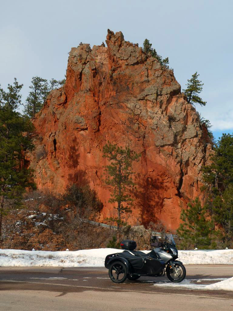
The day's first pictures were at the Buffalo Herd Overlook exit on I-70 before Bergen Park.  As you can see, the buffalo herd was in evidence and the view one gets of the mountains was spectacular!


I left home at 10:33AM and by 12:25 PM I was climbing on US6, away from the I-70 Super Slab and heading towards the summit two miles away.  It was a bit chilly in the mountains but nothing significant to report, it was only noticeable when in the shadows of mountains and when flanked by pine forests.  In the sunlight, more than a mile closer to the sun than you folks at sea level, it felt like a perfect day for riding.

 Here's Yoshie at the first hairpin turn on the way up to the summit
of Loveland Pass

 I was shooting the same shot, first in "snow" mode, then dynamic ratio then 
in auto mode.  Snow mode was the clear winner today when it came to shooting
stuff with a lot of snow in the picture!


 Above and below, Yoshie looks towards the summit


 Above, Yoshie is past the summit of the pass, and using
the mountain range to the west of the Divide as background

 The sky was a gorgeous color of blue today, don't you think?

 A zoom view of distant peaks from the second to last hairpin one can
park at before arriving at the Arapahoe Basin Ski Resort

The view from the second to last hairpin before A-Basin

After I descended past the A-Basin Ski Resort and the full up parking lots, I soon arrived at the Keystone Ski Resort and after a bit of wandering, found the road to the town of Montezuma.


From Wikipedia:  The town, which is named for Montezuma, the Emperor of the Aztecs, consists largely of historical buildings and houses lining unpaved streets at the end of the paved county road that ascends the Snake River from Keystone near the west side of Loveland Pass. The town sits in a high steep valley surrounded by forested peaks offering good access to higher national forest land destinations. The paved road up from Keystone leads mainly through national forest right up to the entrance of town, which is marked by a sign over the county road.


The town retains many older structures, some of them dating from the late 19th century, such as the picturesque school house dating from the 1880s, now a State of Colorado Historical Site. The town is often included in lists of ghost towns in the Colorado Rockies, but it nevertheless retains a small population of full-time residents, as well as many absentee homeowners.


Montezuma has some of the most popular backcountry skiing, biking, snowmobiling, snowshoeing and hiking trails in Summit County. Montezuma is listed as one of Colorado's top scenic places in John Fielder's Best of Colorado

LINK to more info about the town of Montezuma

The above entry from wikipedia had lured me to try and ride to Montezuma and see what John Fielder meant in terms of it being one of the top scenic places in Colorado.
I found the town to be quaint, quiet and pretty but I'm not sure I'd put it in the top ten of scenic places I've ridden to in Colorado.  I rode through the town, all the way to the trailhead parking area leading towards Webster's Pass and had to turn around at that point.

 Looking towards the direction of Webster's Pass from the 
middle of  Montezuma town


I retraced my route back to Keystone (no real choice, there's only one road in and out) and before I started heading back up to the summit of Loveland Pass, I mounted the GoPro camera onto the sidecar.  Check out the youtube video at the end of this posting.  Here's some more pictures I took of Yoshie and the surrounding scenery as we made our way back towards the summit and eventually the I-70 Super Slab.


 One last shot of the mountain peaks near Loveland Pass

The rest of the ride was just making my way home, at which I arrived around 3:30PM.  A pretty enjoyable ride in spite of the unexpectedly heavy traffic both going up and down the mountains.  I saw about a handful of motorcycle riders enjoying the "warmish" weather today, hope you got a ride in as well!

Wednesday, December 28, 2011

Longs Peak in the evening

Short ride in the eastern prairies, not much presented itself for photographing.

So I give you a briefly sunlit view of Long's Peak, one of the larger mountains visible along the Front Range:

Monday, December 26, 2011

Castlewood Canyon and Perry Park after Christmas Ride

A mostly sunny and somewhat "warm" day here in Colorado.  My family was meeting with a friend of Martha's from college and so I went off to ride part of what I call the "Southern Loop" of motorcycle friendly roads.

My first stop was Castlewood Canyon which is located south of the towns of Parker and Franktown respectively.  As I was near the spot for an overlook of Pikes Peak, it was here that I stopped first before going into the state park.

Pikes Peak Overlook from CO83

I then returned to Franktown and took the main road west to the next turn which allows one to enter Castlewood Canyon State Park by way of a county road.  First though I detoured onto Willow Lake Drive to peruse the offerings in terms of scenery provided by the ranches and valley views.

 A view to the east along Willow Lake Drive

Still along Willow Lake Drive, this time with the canyon walls as backdrop

The road into Castlewood Canyon State Park

I went all the way past the failed Castlewood Canyon Dam of yesteryear, turned around and exited the park the same way I'd come in.  The dirt road was snow-covered mostly but not much in terms of ice, just had to take it easy on the inclined portions.

Arriving once again in the outskirts of Franktown, I continued heading east on CO86 to the town of Castle Rock.  I saw the town's namesake soon enough and found a spot at a local elementary school at which to pose Yoshie:

 Castle Rock

  A view of a neighboring hillside, near the base of Castle Rock

I left Castle Rock by way of US85, crossing over the I-25 Super Slab and getting onto Wolfenberger Road which winds its way to the valley which is traversed by CO105, a favorite of motorcycle riders during the warmer months.  

I rode all the way down to the Perry Park area and got onto Red Rock road to go see the small version of the "Garden of the Gods" that John Sanoke had first shown to me so many years ago.  There was much more snow on the trails this time than the last time I was there with the Uralisti seeking snow to play in.

 One's first view of the rock formations in Perry Park
from the entry point on Country Club Drive


I only got stuck once in the snow, when I got a bit too close to the edge of the road and the sidecar got sucked in by the snowbank.  No worries though, I was out within minutes with no real effort.

 The above picture shows where I got "stuck", so
I got a picture of Camel Rock first, then got unstuck.

 That hill behind Yoshie would prove a tiny bit of a challenge
on the way back out.

 This is as far as I got within Perry Park, the snow got too deep
at this point.  Just behind Yoshie and out of camera range, was a stuck
4WD truck which had been left abandoned in the snow.

The signature rock formation for which the Perry Park Golf Course
is known for.


Once I left the golf course area, I took a slight detour onto Echo Valley Road to get a picture of the ridgeline on top of which is built the Perry Park Country Club.

Echo Valley Road

As one reaches the junction of Perry Park Boulevard and Red Rock Road, two big rock formations draw one's eye to their rich colors and majestic size:

 Lovely red rock formations


Heading back out of the Perry Park area by way of Red Rock Road, you can position your ride along Red Rock Circle for this nice view of the richly colored rock formations that line Red Rock Road.  One can see why the folks who built along this line of rock formations chose that location!

Red Rock Road, from Red Rock Circle.

It was mid-afternoon by now and I motored on home, basically retracing my path back to Castle Rock by way of Sedalia.  I then took the Crowfoot Parkway to Parker town and headed up Inspiration Drive to get back to Centennial.  The deer were already out, I must have seen at least a dozen deer, in clumps of 3-4, feeding near the road side.

Got home with no incident and ready for some warmth and food.  About six hours out in the 40s in terms of temperature so the cold was starting to seep in a bit.  Still, a great ride and got some nice pics thanks to lighting provided by the motorcycling gods.  Here's hoping you got a ride in today.


Sunday, December 25, 2011

Christmas Day ride by some snow-clad prairies of Colorado

Here's hoping you all had a very Merry Christmas Day!

The Chang family had a great and yet calm Christmas Day, a sumptuous feast the night before provided by my loving wife and everyone was happy with their presents from Santa this morning.

The temperature had soared to 45°F and sunny so I went for a short ride in the prairies just a few minutes east of my home neighborhood.  The air felt downright balmy with a slightly chilly wind helping to remind one that it was Winter in Colorado.

 Lonely county road, bisecting large prairie grass fields 


My route entailed a small loop of county roads as I rode about enjoying the calming effect of the snow-clad prairies and the feel of being alone with my trusty steed purring smoothly underneath me.

As I was heading home, I spotted what looked like huge flocks of geese just walking about in a farmer's field bordering the county road I was riding on.  There must have been hundreds if not thousands of these geese just loitering about!

I got perhaps as close as 300 feet, this is shot with my Panasonic
Lumix at full optical zoom.

I passed the largest flock and parked Yoshie by the side of the road and slowly walked closer and closer to the the nearest flock of geese.  They were a bit skittish so my progress was slow but steady.  I hope you enjoy the film below, I found their site and actions quite calming and realized that they were a Christmas gift from the motorcycling gods.  


See?  It pays to ride when there's snow on the ground!  

Saturday, December 24, 2011

Christmas Eve Ride to Lookout Mountain and Red Rocks Park

A gloriously sunny day here in the Denver Metro Area where we continue to deal with the heavy snowfall that blanketed the area a couple of days ago.

My Cul-de-Sac, which I "tilt-shifted" using an online app,
trying to make my neighborhood look like a toy model

 The birds roosting in the tree behind my house reminded
me of a Christmas Tree with the birds as decorations.

Closeup view of one of the birds....weathering the 23°F cold

The neighborhood streets are still snow-covered and slick to negotiate but I rode out easily on Yoshie, my V-Strom/Dauntless Sidecar Rig to run an errand and see what I could see....

I headed west through Denver using I-25 to US6 and made it to Golden with no issues and in good time.  The highways were nice and dry by the way so getting to the west side of town did not involve "adventure".

Once in Golden's outskirts, I took the turn to get on Lookout Mountain Road and started riding up this twisty and steep road towards the top of the mountain.  There were many stretches of ice-covered road and despite the liberally strewn sand and gravel, no place for a two-wheeled motorcycle!

 More tilt-shifted images:  Above is the city of Golden, with the Coors
Brewery holding the state between the two mesas.

 Golden neighborhood at the foot of the Lookout Mountain

South Table Mountain

I made my way to the top of Lookout Mountain with no issues to speak of, lots of ice and loose snow but nothing Yoshie couldn't handle with her pusher snow tire.

Descending from Lookout Mountain, I turned back eastward on US40 heading towards the town of Morrison, with a final destination of Red Rocks Park.

Red Rocks Park was pretty with its own snow cover.  The roads through the park were pretty clear mostly and there were several cars moving about taking in the sights as I was.

 Creation Rock, this shot would end up costing me a lot of energy and effort.

After taking the above shot, I thought I'd exit the snow-covered parking lot by following ruts that had been created by cars before me.  It was shorter to try and exit by the entrance near Creation Rock than to turn the rig around I thought.  Yep, there I go, thinking again.

I made it to within perhaps 200 feet of the entrance and then got bogged down in some deep snow.  There followed first several attempts to make it out the desired entrance and failing.  Then I got Yoshie turned around since going back the way I came was somewhat downhill vice the uphill way I was previously attempting.

The going was slow and hard, I would gain a few feet then get bogged down.  Then there would be more digging her out, pulling her out  of the deep snow that the sidecar kept dragging me into, then gain a few more feet.

Repeat the above, many, many, many times..... 

Over an hour and a half later, I was getting close to where the snow was not so deep.  I had made a couple of good long runs but the last one ended with me in some deep stuff that took a while for me to dig the rig out of by myself.  Of course, none of the cagers cruising by stopped to offer assistance.  In a way though, that was good as I wanted to "self-recover".  

Finally, got Yoshie dug out for the final time, aimed the right way through some pulling and pushing and gunned the engine.  Some initial spinning and then the motorcycling gods finally took pity on me and allowed Yoshie to gain enough traction to build enough momentum for me to force my way through the snow and reach the other parking lot entrance and clear roads!  Yay.  

A couple of families who had parked nearby as I went for the final push had offered to help but I declined.  They all cheered as Yoshie and I motored out of the deep snow....a very satisfying feeling I might add.

Just to give you and idea of the conditions Yoshie and I dealt with....

I drove along the road next to the snow-covered parking lot and parked Yoshie to retrieve all my riding gear I'd shed in the efforts to dig her out.  You can build up a lot of heat, I am here to tell you, when wresting a 900+ lbs rig out of deep snow.

I made my way out of Red Rocks Park, too tired now for more pictures and not wanting to get stuck again while doing so.  Made my way homewards, ran my errand, and got home shortly after 1:00PM.  Washed Yoshie down to get rid of all the magnesium chloride that the city coats the streets with; the pavement was wet with melting snow you see and Yoshie was covered in this stuff and the dirt I dug up at Red Rocks.

So, a great ride, a little bit of adventure, a chance to try rig-recovery techniques, some lessons learned and a few pictures.  

One final picture for you, my readers, courtesy of Photoshop to be sure but still, with heartfelt wishes from the Chang family.   


Friday, December 23, 2011

Miscellaneous Snow Riding Pictures

Rather than disturb my readers with my smiling face in the last posting about my new helmet; I thought I'd post some pictures I've taken the last few days as snow has covered the Front Range.

We're definitely going to be having a White Christmas here in the Denver Metro area. I get enough snow to go riding/playing in with Yoshie, my V-Strom/Dauntless Sidecar Rig, and there's not too much that the snow plows can't keep the streets plowed.

 Taken on 19DEC as I was doing some work at one of eCollege's 
data center locations.  The snow fall total was perhaps two inches.

 On 20DEC, I rode into work (of course) and play around a bit on 
the roof of the parking garage next to the building I work in.

 Mount Evans

 The Chang BBQ Snow measurement device
showing snow accumulation from the 21-22DEC snow storm.

Today's morning ride in search of snow-clad  trees before the sun
melts it all off.