Thursday, April 18, 2024

Driving Capitol Reef NP's Scenic Drive, Hiking The Tanks Trail and a little T-Dub'ing

 Sunny day with some noticeable but not bad winds.

Martha and I drove over to the Capitol Reef NP's Visitor Center located just off the US24 Highway about six miles east of Torrey, UT.

After getting her Park Passport book stamp and a map, we drove onto the Scenic Highway deeper into the park.  First, a stop at the Gifford Farm where a museum and store is located.  Mainly, to get a pie sample.  

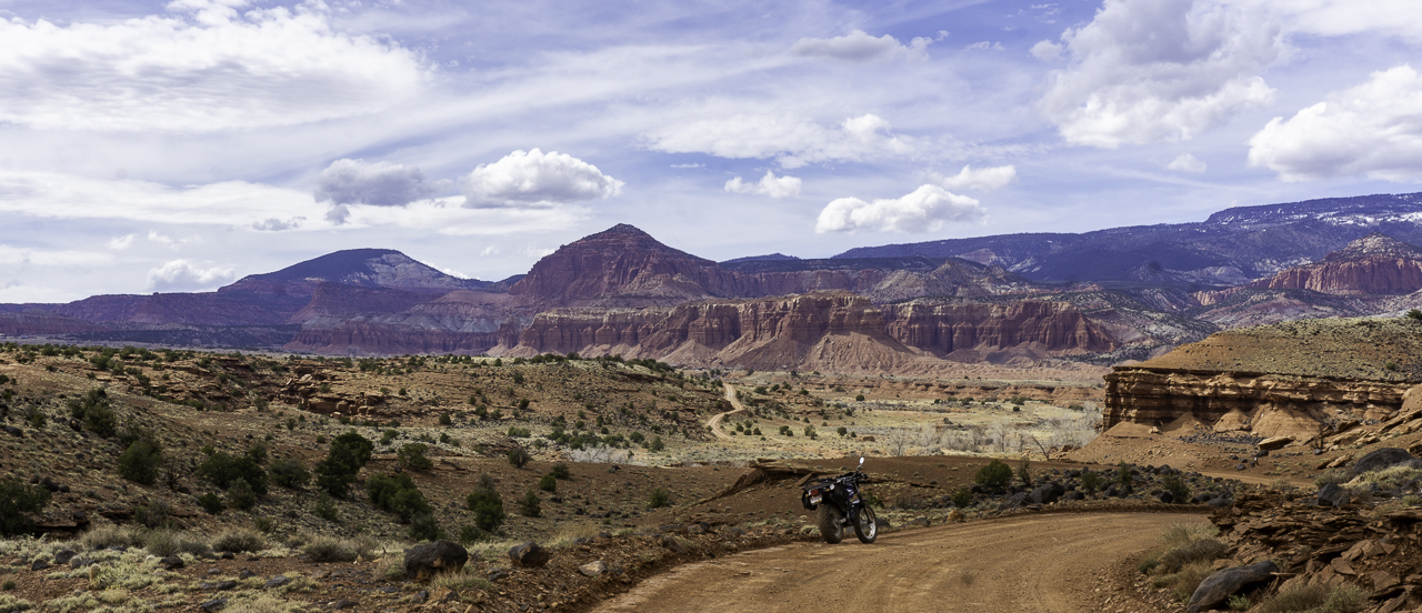
The drive into the scenic highway's rock formations was "into the sun" so we didn't stop for pics or use any of the dashcam video footage.  We got to the end of the road where there is a small trailhead.  Parking was an issue and we ended up parking in a small spot at the end of a line of parking spots.  When we returned it was a cluster-f*ck of a parking area.  

The Capitol Gorge Road trail is pretty level and we walked about a mile in, I think you can take this trail all the way to the small town of Notom, UT but we wouldn't be going that far.


The gorge is obviously by definition bordered by high rock walls.  We were walking where water once flowed (and probably does during floods and heavy rains).

We walked past Pioneer Register where people from the past left their mark and names while transiting this area.  There's also a bunch of modern era ass wipes who left their names on the rock walls.  I guess they didn't see the sign stating it's illegal, after all what's historical value compared to a fleeting Instagram posting right?

Anyways, we got to the start of The Tanks trail which led up some sketchy looking terrain:

Martha of course was up for the challenge and up we went.  It was signed as 0.2 miles long, the trail.  It wasn't too bad but some parts required due care.

Still we made to within sight of "the tanks".  You can see water collecting in one of the pictured holes below.


Here's views from the trail, a bit higher than the gorge's road bottom:


The walk back to the trailhead was without any issue, just a short stop to get a picture of layered rock that I found interesting:


We apparently were here at a good time this month.  The "Scenic Road" will be closed for construction starting April 30, not sure when they'll be finished but pretty sure not for a few months.

We tilted the dashcam lens a bit for the return trip from the trail head area:


This will probably be last of this type of dashcam video, lots of time to convert/edit. (the crowd cheers...)

A bit past 3:00 PM, I went on a ride on Yagi, my TW200.  I just rode what trails were available around the campsite area.  Found  that Sulphur Creek Road leads one into the Capitol Reef NP a short ways before it meets up with the US 24 Highway at Twin Rocks:


The afternoon had turned mostly cloudy, leading to some dark lighting for the landscape, but still it was OK as I retraced my route back towards camp:


I even found a small water crossing along the way:


I wandered out of the camping area and found another BLM gate to the ridge next to our campsite's ridge.  I wandered for a bit but there wasn't much riding to be done before one ran out of trail and faced the edges of the eroded ridge.

Still, one spot gave a good view of the two prominent mountains to the west near Torrey.  The one on the right is unnamed according to the Peakfinder app.  The one on the right is called The Ant Hill.  I would have thought the unnamed formation would be called Ant Hill but what do I know.


Tonight's sunset was pretty good:

Wednesday, April 17, 2024

Boondocking near the Capitol Reef National Park

Martha and I displaced at 8:30AM from near Westwater, UT and by Noon were near the town of Torrey, UT, on the western side of the Capitol Reef NP along the US 24 corridor.

We found a nice spot near the town though a bit windy, conditions were otherwise optimal.


Shortly before 3PM, we headed out in the Honda CR-V about 7 miles to Panorama Point and the Goosenecks Overlook.  We went to the Goosenecks area first, walking the 1/3 mile or so to Sunset Point:

Sunset Point


Returning to the car, Martha rested a bit...

Goosenecks trail is in the same trailhead for Sunset Point.  It was a short 600 ft walk amongst rocks and boulders to the overlook.

Surfing the winds at the overlook.

That's Sulfur Creek down there....

We returned to Panorama Point:


We've recently added a 70MAI Brand Dash Cam to the VRRV/CR-V.  Mostly for recording incidents while driving but we're also exploring it as a travelogue tool.

See what you think of this video showing snippets of us driving to and from Panorama Point.


Tuesday, April 16, 2024

Visiting Arches NP and a Bonus Rock Formation Find

 A good day of car touring with a bit of hiking among large and scenic rock formations!

We had an 11AM reservation to enter the Arches National Park and were let in by 11:15, not too bad a wait at the fee gate.

The reservation system does seem to cut down on the crowding of the more popular parks but as the day wore on, more and more crowding conditions evidenced themselves.

Still, we got to see the rock formations Martha wanted to see.  It has been over 20 years since she'd last been at Arches NP.  In fact, she was pregnant with Thing Two at the time!

Park Avenue

Courthouse Rock

We next drove over to the Delicate Arch View Point.  A short hike but very steep at times, we may have been huffing and puffing at certain points.

I mentioned to Martha we could see the Delicate Arch from the below point along the trail, but she wanted to get closer:


Telephoto shot of the Delicate Arch with people for scale perspective:


I'd been to the actual arch on a previous trip, see here for pics closeup:  LINK

Next stop, Devil's Garden:

Entrance to the garden

Tunnel Arch


Pine Tree Arch


Part of the Devil's Garden

Finally, a short stop at the park's visitor center so Martha could get her Parks Passport book stamp.


After Arches, we stopped at the Moab Museum of Film and Western Heritage.  It was a small affair, mostly pics of folks involved with filming history in the Moab area.

As we headed north on Utah 128, I spotted a sign for Fisher Towers!  I recalled that lovely rock formation at the end of the movie: 6 Underground

The closest point you can drive to...

About 1/2 mile from Fisher Towers

Back on northbound UT 128, Martha had spotted a rock formation which looked like Hellenic Towers perhaps:  On the right below, Fisher Towers, on the left the columns:


We got back to camp sometime before 4PM and we did some packing up for tomorrow's displacement westward.  It was a bit windy but not too bad and warm enough today to almost break a sweat while hiking.

Monday, April 15, 2024

Boondocking in Utah - Near Rabbit Valley Overlook

Sunday, April 14

Martha and I left the overcrowded cesspool that is the I-25 Corridor of the Colorado Front Range at 8:30 AM, heading west on the I-70 super slab.

We made good time, had good weather, and though quite slow on the uphill portions of the mountain areas, the VRRV did just fine.  It even reported almost 9 MPG when we refueled in Rifle, CO.

Here's some shots by Martha with her iPhone as we went through the Glenwood Canyon portion of I-70.  A very scenic portion of the interstate!


We refueled at Rifle, CO.  Had to wait a bit while the below hunters did their weekly grocery shopping while tying up a gas lane.  How do you like the guy's "camie jammies"?

We made it to our camp spot, near the Rabbit Valley Overlook area off of exit 227 once you cross the border into Utah on I-70.

We missed the first turn but that worked out OK because the next spot had a nice and wide spot for the rig with Honda CR-V in tow.

The cell signal is weak, we had to use the weBoost, but the area is quite nice and has several dispersed camping spots well distanced from each other.  

The CR-V guards the entrance to the camp site

Spent a lot of the afternoon troubleshooting an intermittent running of the water pump.  It would cut on without any visible leaks anywhere, run for a second or two, then cut off.  Rather annoying.

Tried the spare water pump (which I had refurbed but not really tested) and it turned out to have a leak.  So I put the existing pump back on and noticed that there was a 15 degree tilt or so of the tubing leading to the intake line.  

So I leveled the lines back up, confirmed it still drew water and now there's a small box supporting the lines near where the draw tube is located.  This seemed to solve the intermittent on/off issue.  Weird.

Monday, April 15

Happy Tax Day?

Under windy and blustery skies, we did a short ride in the CR-V down to the Westwater BLM Campground and Boat Ramp.  It provides a few dry campsites for $20/night but mainly boat access to the Colorado River.

Returning to camp, the sun broke through finally and the rest of the day was sunny though cool.  After a late lunch, I went out riding on Yagi, my TW200 while Martha read inside the VRRV.

I found the nearby Kokopelli trail and wandered about looking for views.  I missed the turn at first and ended up in some gnarly technical bits of the trail, lots of loose rocks and ruts.

Here's a view of distant rocks and mesas from the furthest point I rode to before turning back:


Finding the right trail, I rode to the junction of Arches Loop and Overlook Trail.  The terrain got quite steep on the Arches loop and the Overlook Trail wasn't much better so I turned around after getting these pics:


Coming down off the hills, I spotted the campsite:

Can you see Uma?

I made it back to camp with no issues.  The weather was moving in as you can see and we're expecting a bit more sprinkles of rain this evening.  Tomorrow: Moab.

Tonight's sunset: